Uploads by Admin
Jump to navigation
Jump to search
This special page shows all uploaded files.
| Date | Name | Thumbnail | Size | Description | Versions |
|---|---|---|---|---|---|
| 17:30, 4 March 2025 | Image.png (file) | 287 KB | 1 | ||
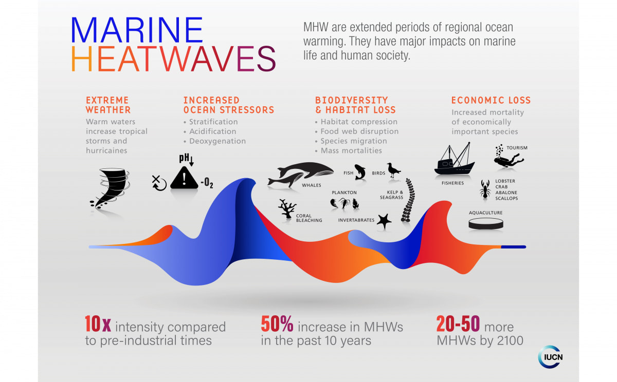
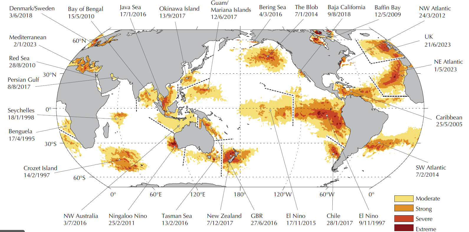
| 16:19, 24 October 2024 | Marine heatwaves2.jpg (file) |  |
126 KB | 1 | |
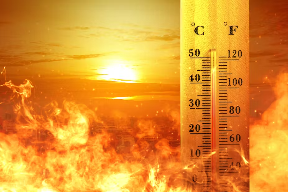
| 14:03, 24 October 2024 | Extreme heat2.png (file) |  |
710 KB | 1 | |
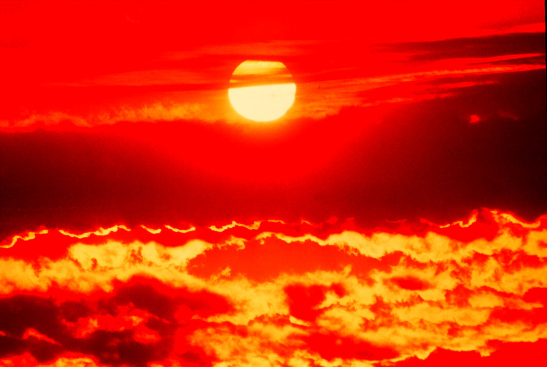
| 13:54, 24 October 2024 | Extreme heat.jpg (file) |  |
219 KB | 1 | |
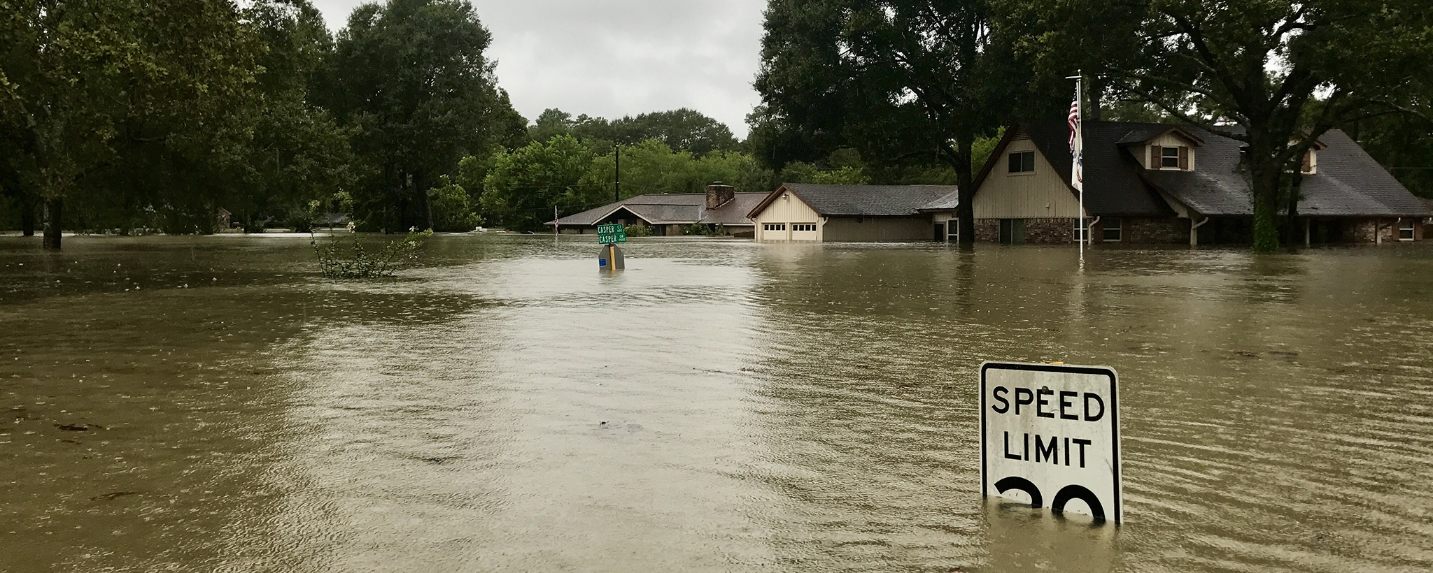
| 13:54, 24 October 2024 | Flooded-neighborhood 1.jpg (file) |  |
1.38 MB | 1 | |
| 13:54, 24 October 2024 | Drought.jpg (file) |  |
237 KB | 1 | |
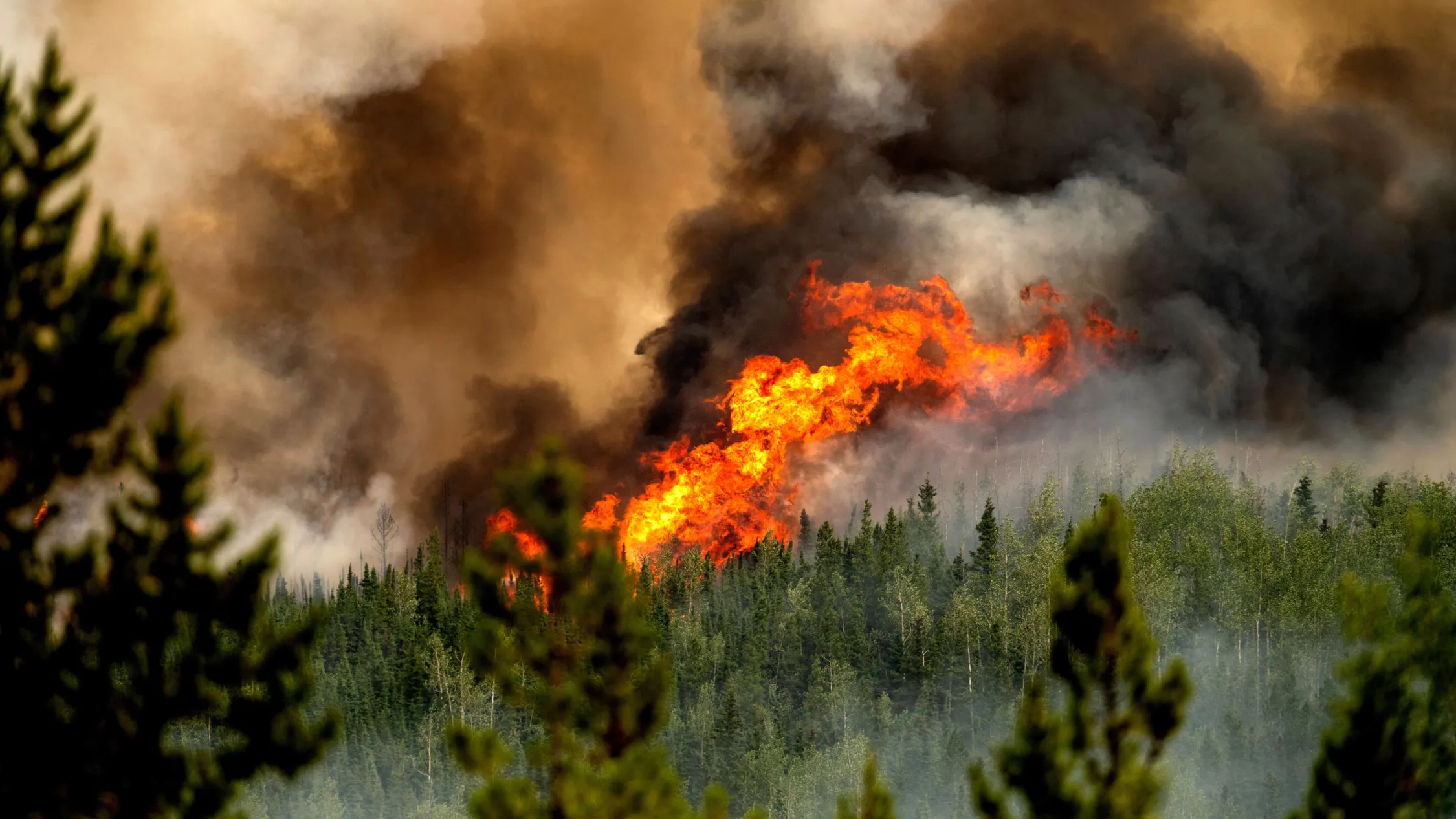
| 13:53, 24 October 2024 | Wildfires.webp (file) |  |
206 KB | 1 | |
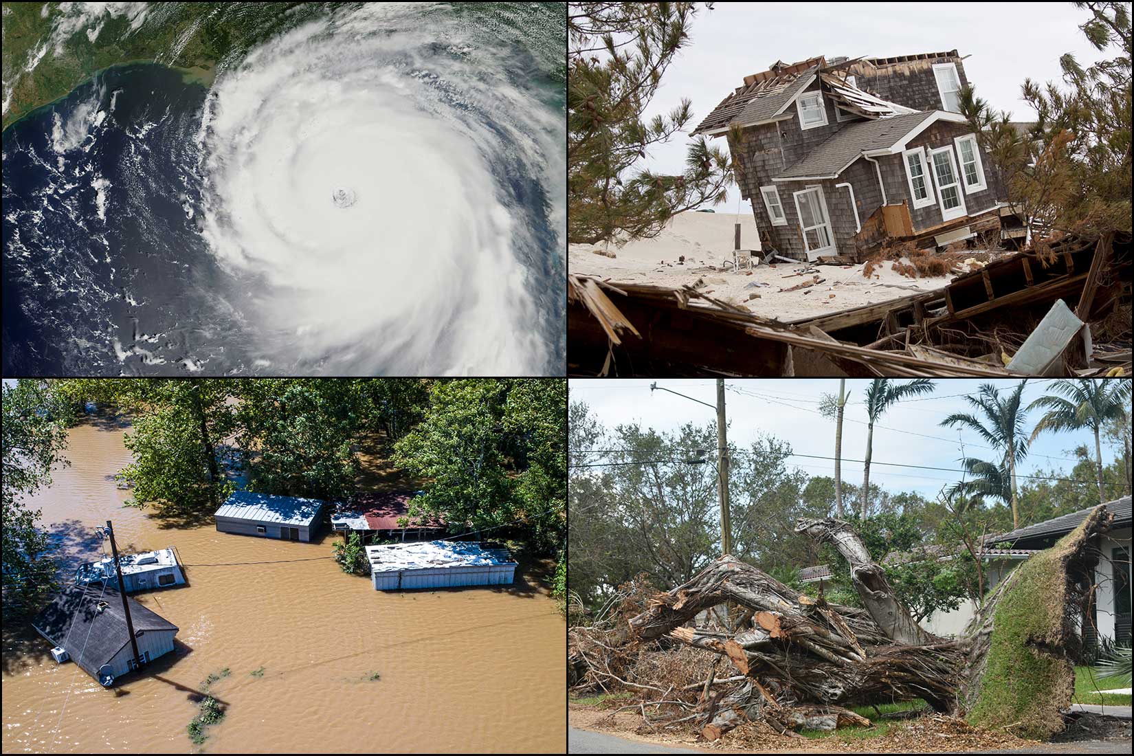
| 13:53, 24 October 2024 | Hurricane1.jpg (file) |  |
351 KB | 1 | |
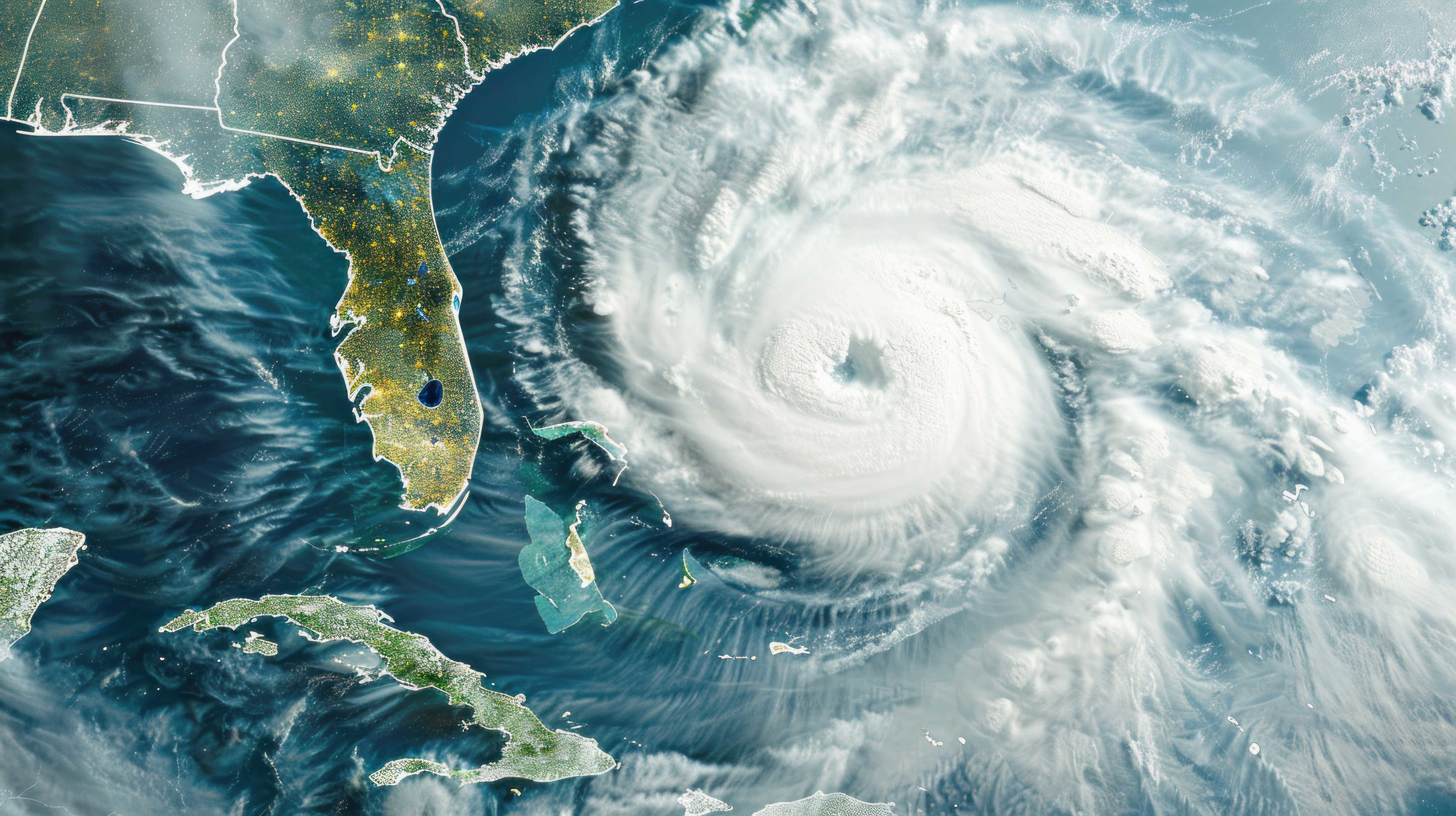
| 13:53, 24 October 2024 | Florida Hurricane.jpg (file) |  |
1.9 MB | 1 | |
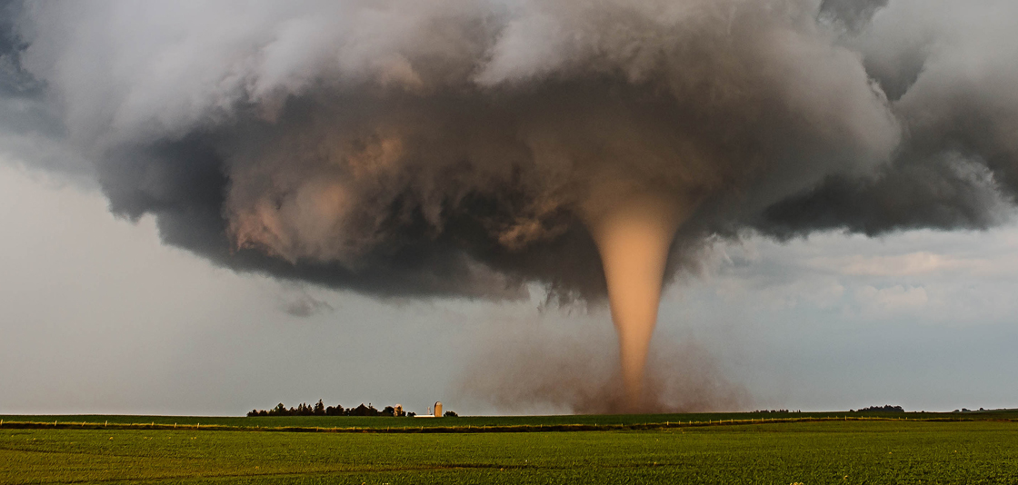
| 13:52, 24 October 2024 | Tornadoes.jpg (file) |  |
368 KB | 1 | |
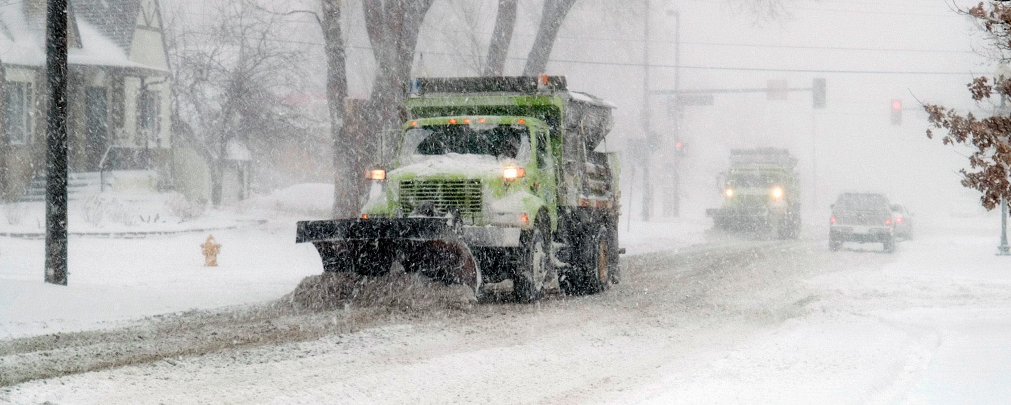
| 13:52, 24 October 2024 | Winter storms.jpg (file) |  |
410 KB | 1 | |
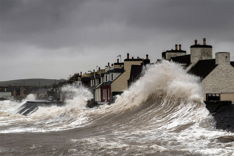
| 13:52, 24 October 2024 | Storm-surge.jpg (file) |  |
140 KB | 1 | |
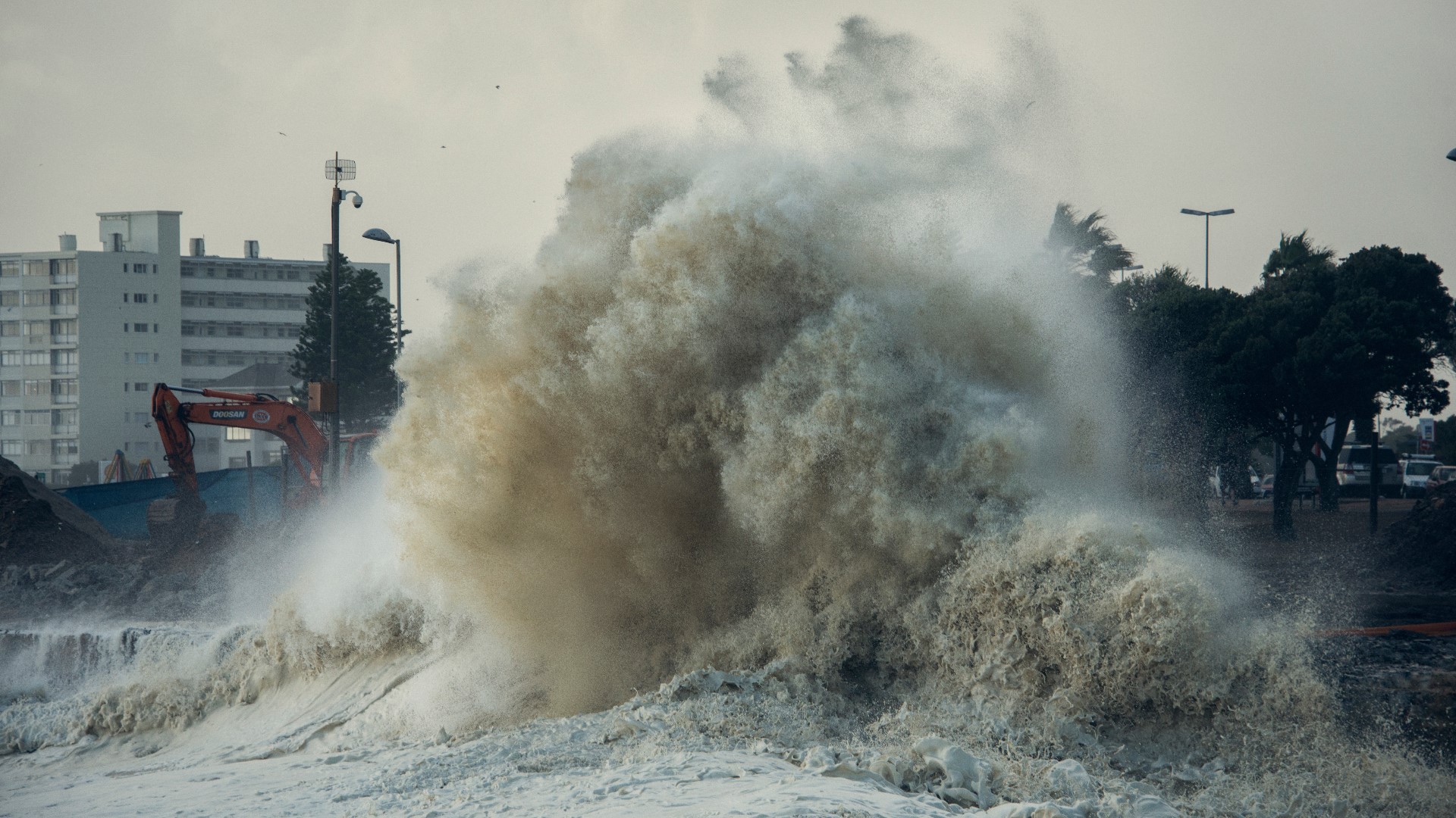
| 13:51, 24 October 2024 | Storm surge2 king5.jpg (file) |  |
520 KB | 1 | |
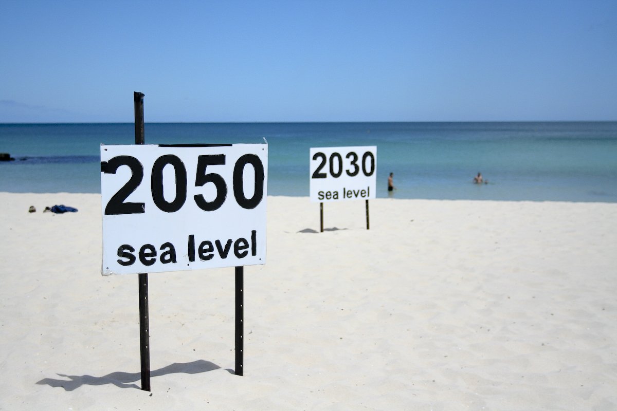
| 13:51, 24 October 2024 | Sea level rise.jpg (file) |  |
82 KB | 1 | |
| 13:51, 24 October 2024 | Marine heatwave.png (file) |  |
276 KB | 1 | |
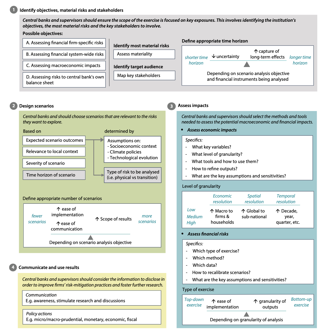
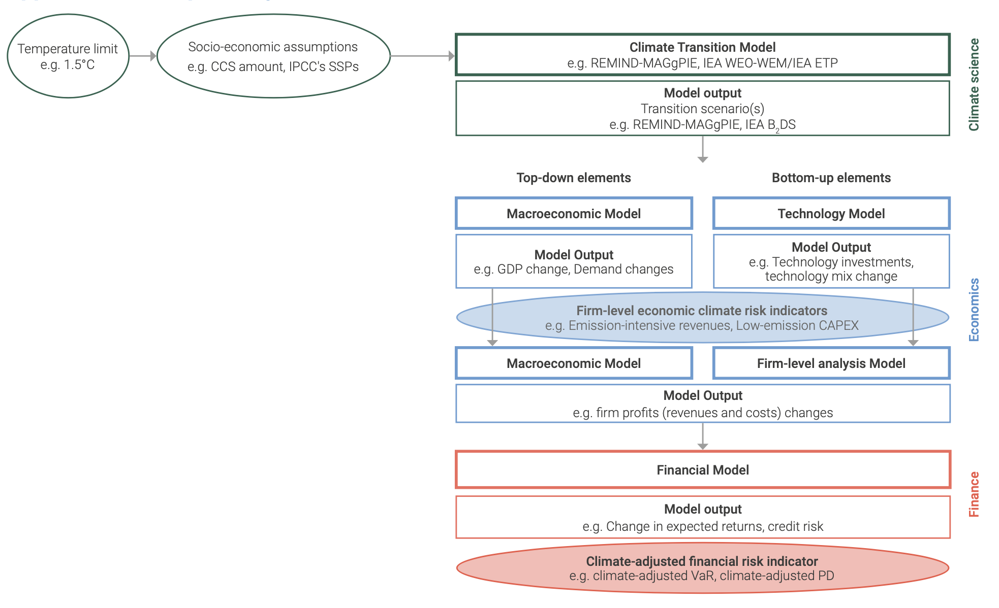
| 16:33, 23 October 2024 | Scenario analysis process.png (file) |  |
379 KB | 1 | |
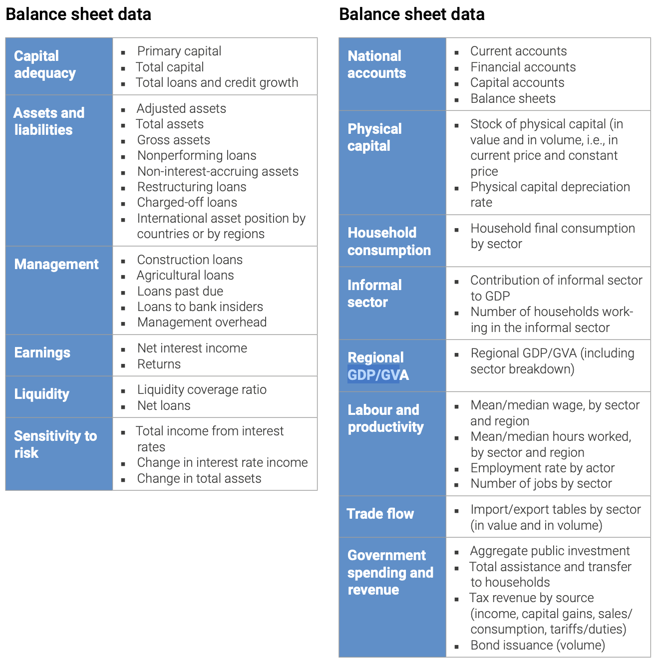
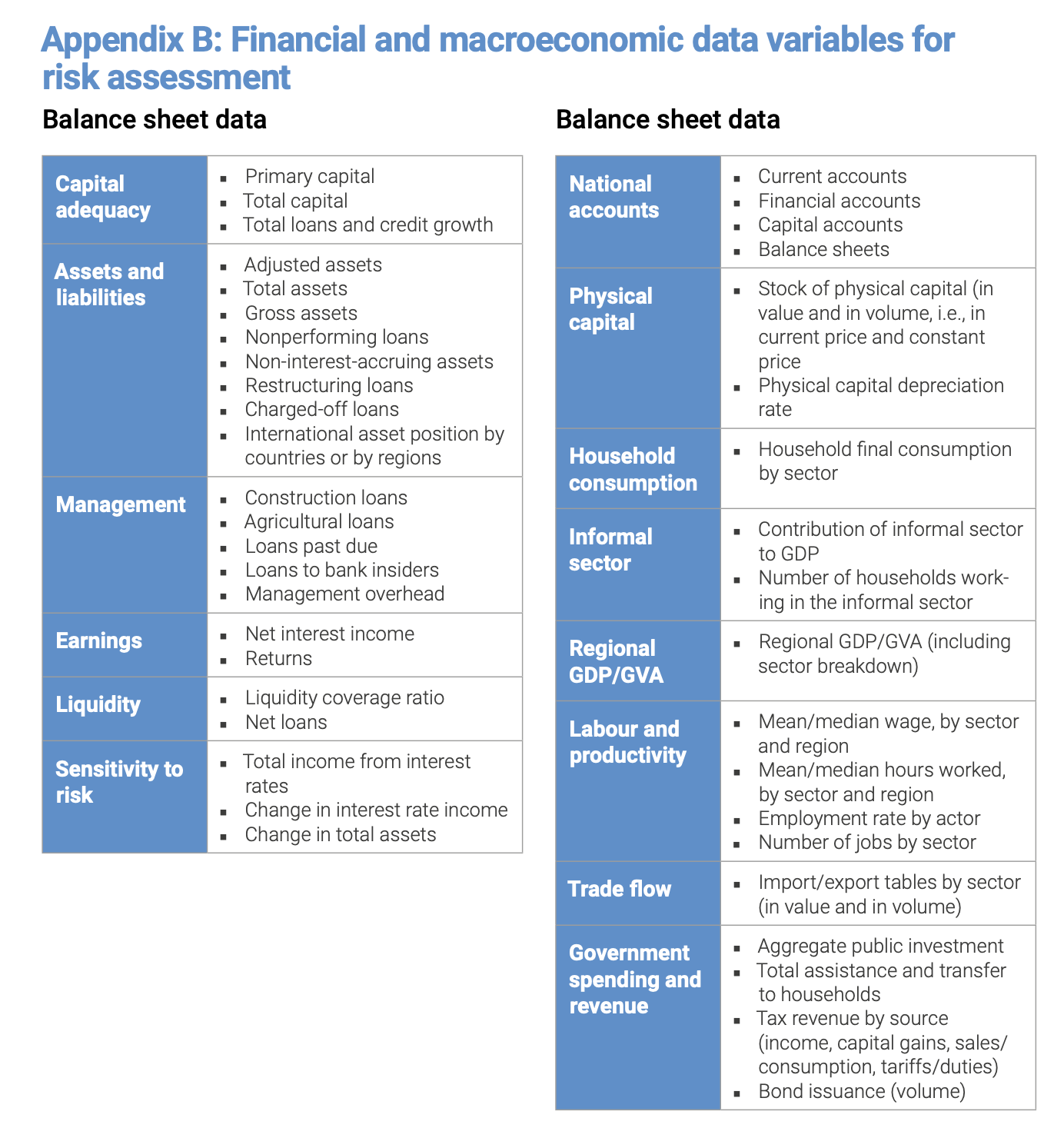
| 13:58, 16 October 2024 | Financial data needed.png (file) |  |
382 KB | 1 | |
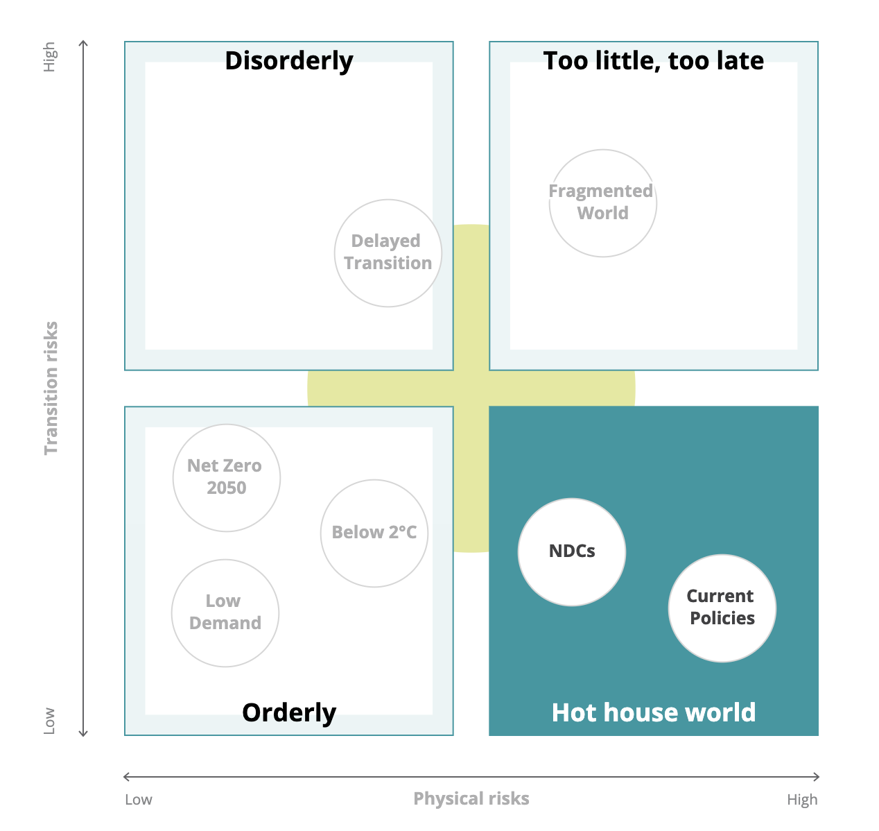
| 13:45, 16 October 2024 | NGFS scenarios.png (file) |  |
148 KB | 1 | |
| 13:19, 16 October 2024 | Screenshot 2024-10-16 at 6.18.40 AM.png (file) |  |
414 KB | 1 | |
| 13:00, 16 October 2024 | Schematic transition risk.png (file) |  |
275 KB | 1 | |
| 19:01, 15 October 2024 | Schematic acute risk.png (file) |  |
159 KB | 1 | |
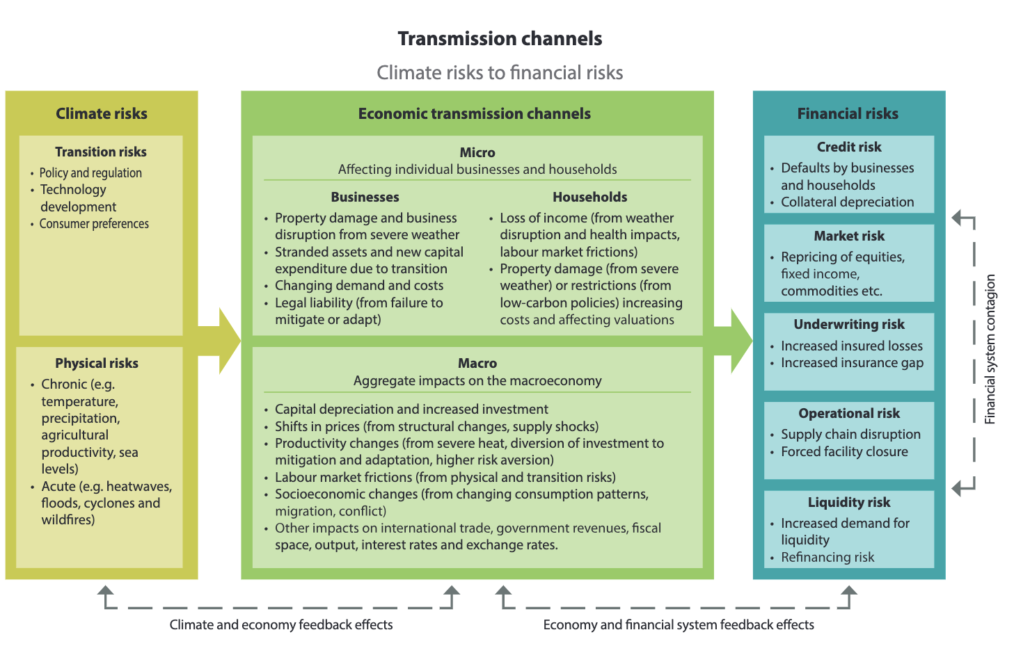
| 18:43, 15 October 2024 | Transmission channels.png (file) |  |
345 KB | 1 | |
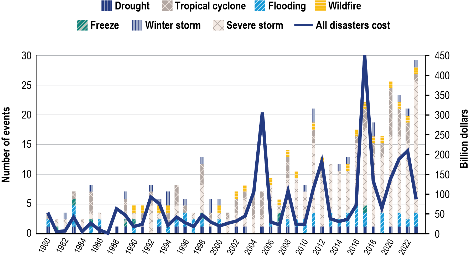
| 22:12, 9 October 2024 | F1-29-US-Billion-Dollars-Disaster-Events-1980-2023.png (file) |  |
164 KB | 1 | |
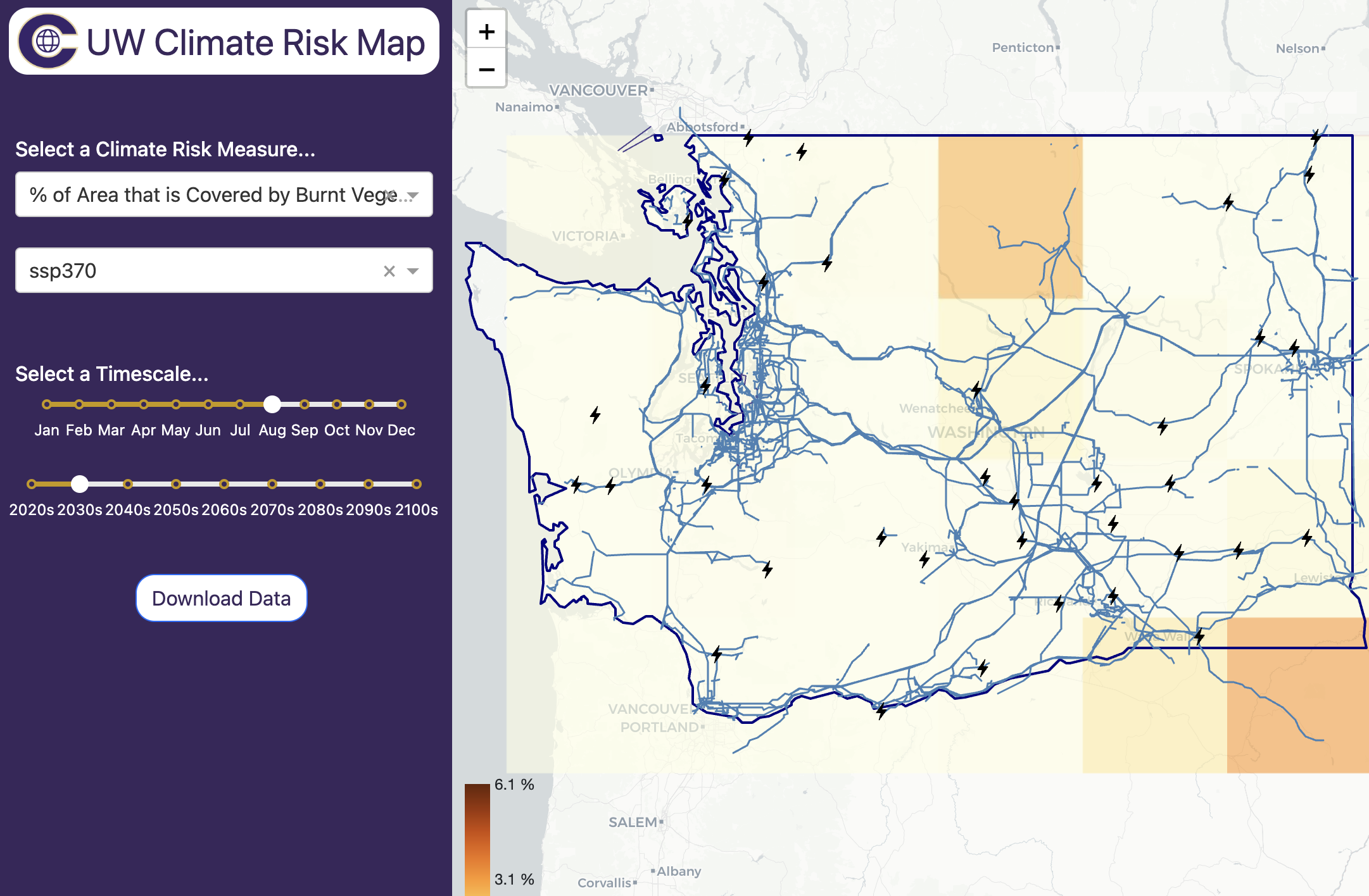
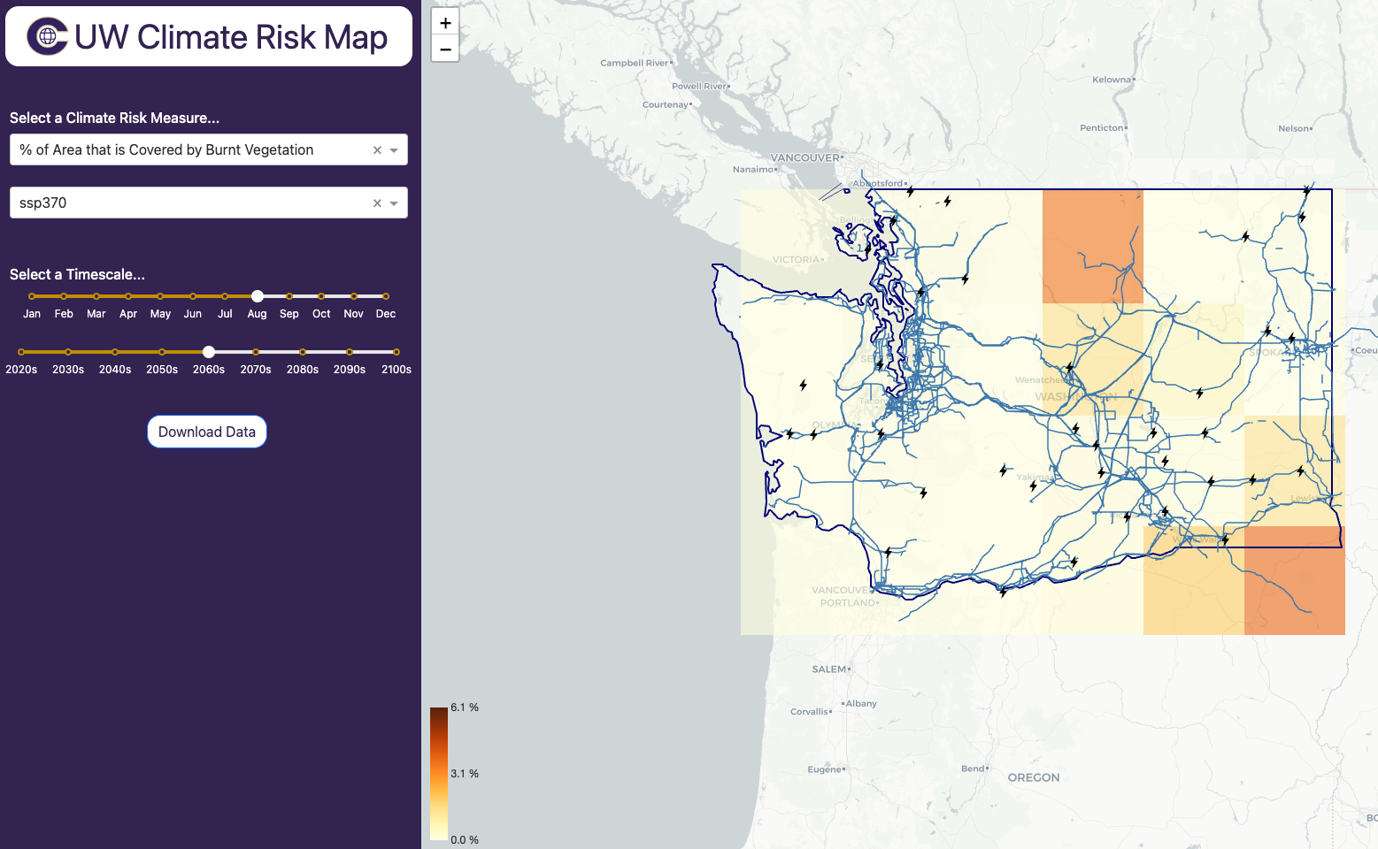
| 21:54, 9 October 2024 | CRL Map 2024-10-09 at 2.53.52 PM.png (file) |  |
865 KB | 1 | |
| 17:58, 8 October 2024 | Climate-risk-map-download-bigger-2024-10-8.gif (file) |  |
6.32 MB | 1 | |
| 17:44, 8 October 2024 | Climate-risk-map-download-2024-10-8.gif (file) |  |
2.38 MB | 1 | |
| 21:42, 7 October 2024 | CRL-Map-Infrastructure-Overlay-2024-10-7.gif (file) |  |
3.01 MB | 1 | |
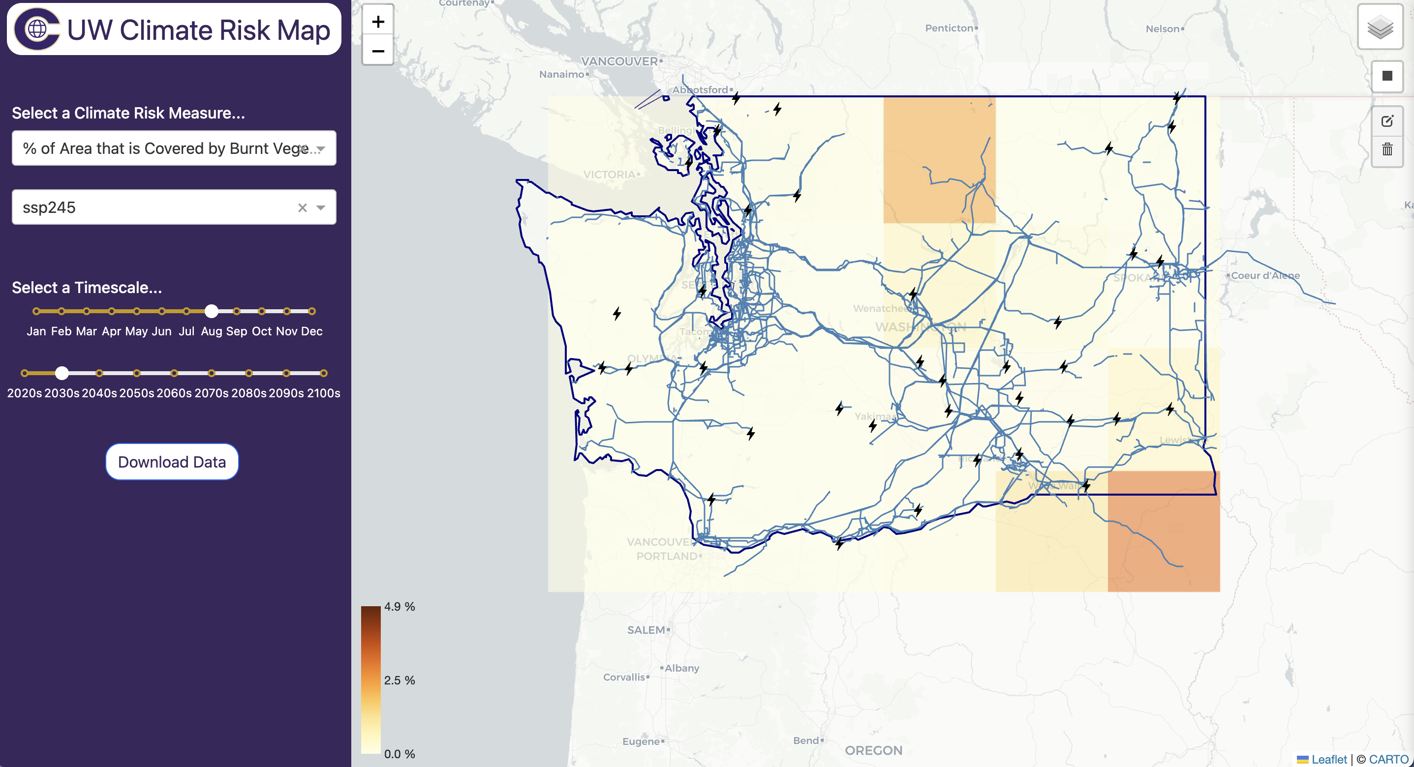
| 19:04, 7 October 2024 | CRL Map General at 12.04.14 PM.png (file) |  |
515 KB | 1 | |
| 18:47, 7 October 2024 | Crl-map-select-dropdowns-small-2024-10-7.gif (file) |  |
2.67 MB | 1 | |
| 18:25, 7 October 2024 | Crl-map-select-dropdowns-2024-10-7.gif (file) |  |
5.59 MB | 1 | |
| 22:03, 4 October 2024 | UW CRL Map Prototype 2.png (file) |  |
1.14 MB | 1 | |
| 21:59, 4 October 2024 | UW CRL Map Prototype 1.png (file) |  |
1,011 KB | 1 | |
| 22:30, 9 September 2024 | Determinants climate risk.png (file) |  |
44 KB | A schematic figure describing determinants of climate risks | 1 |
| 22:15, 9 September 2024 | Determinants of climate risk.png (file) |  |
45 KB | 1 | |
| 23:10, 3 September 2024 | Screenshot 2024-09-03 at 1.20.52 PM.png (file) |  |
1.52 MB | 1 |